Is It Too Soon to
Talk About
Climate Natural Solutions
In Vermont?
By David Mears and Cassie Wolfanger
Just as birds need healthy forests and grasslands, protected wetlands, and connected floodplains for habitat, Vermont’s human communities need those same landscape features to survive the onslaught of weather shifts caused by global climate disruption. Is it too soon after the July 2023 flood disaster to look ahead to the next flood coming to Vermont? Is it too soon to ask whether we should increase our investment in protecting nature’s own flood relief valves given the limits that concrete infrastructure, such as floodwalls and other flood barriers, may have on controlling rivers?
The climate crisis is here, and Vermont is no exception as we experience more frequent and severe storm events. According to the 2021 Vermont Climate Assessment, the state is experiencing an average of 1.4 major flood disasters per year and a 21 percent increase in annual precipitation since 1900, posing significant health, safety, and financial impacts for Vermonters. A recent study predicts that the Northeast will continue to get wetter into the future, despite its reputation as a climate haven. Roughly 21 percent of the country can now expect a severe “1-in-100-year flood” event to happen every twenty-five years. Some of the most extreme cases (over twenty counties in the United States that are home to over 1.3 million people) are expected to experience the current “1-in-100-year flood” at least once every eight to ten years. New England and the Connecticut River watershed can now expect to experience a “once-in-a-100-year” flood every five years.
In fall 2011, Vermonters were necessarily and appropriately focused on helping the many people and businesses displaced and harmed by the catastrophic statewide flooding caused by Tropical Storm Irene. Even then, however, as the depth of the human tragedy unfolded, there were quiet conversations in which many Vermonters began asking whether we should rethink the ways in which we live on the land. Comparisons between flood damage of 1927 and Tropical Storm Irene were made (the 1927 flood damage was far worse), and we wondered if the increase in Vermont’s forest cover and protections of wetlands made a difference in reducing flood damage.
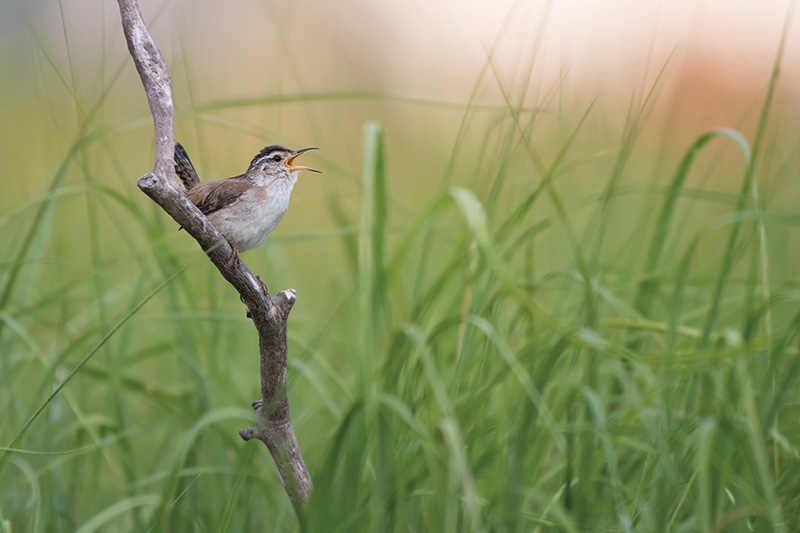
A marsh wren perches on wetland vegetation and sings. Image Credit: Jesse Gordon, Audubon Photograph.
In the years since Tropical Storm Irene, historians and scientists have confirmed those suspicions. Massive deforestation and beaver trapping in the 1800s led to increased flash floods because there were no trees on the landscape to intercept and slow rainwater, wetlands had been drained for development, and rivers had been channelized and cleared of natural woody debris for quick and convenient log transport. With the dramatic change in the landscape since that period, environmental scientists at the University of Vermont and the Vermont Agency of Natural Resources have studied and documented the ways in which past investments in the natural features of Vermont’s landscape have reduced the harm to Vermont’s communities.
Their study found that the frequency and severity of flooding is influenced by three major factors: the amount and timing of precipitation, the condition of the basin’s stream channels and floodplains, and the timing and rate of stormwater conveyance off the watershed. The latter two factors may be the only ones we have any real influence over with the decisions we make on the ground; they are both partly a function of soil condition, extent of impervious surfaces, and health of ecosystems. These are often referred to as “climate natural solutions,” that is, actions to protect, sustainably manage, and restore ecosystems that provide multiple co-benefits to human well-being and biodiversity alike.
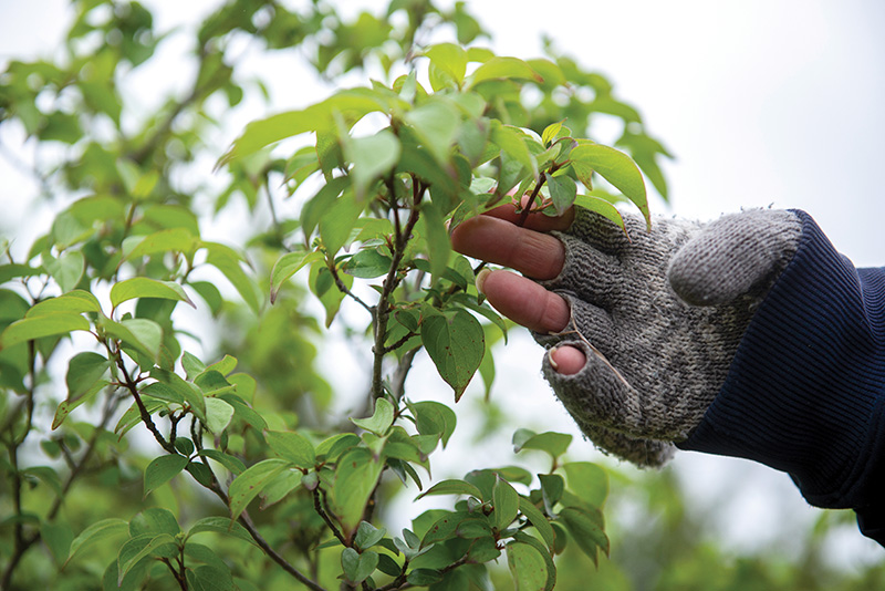
This nature-based approach to flood storage relies on relatively low-cost, low-maintenance conservation practices that increase the density of vegetation cover in a watershed in order to intercept rainwater, sediments, and pollutants and retain them for longer periods on the upland landscape. Restorative strategies can include protecting wetlands, giving rivers full access to their floodplain (i.e., letting floodplains flood and allowing them to meander at will), planting forested buffers, reducing mowing, and incentivizing agroforestry.
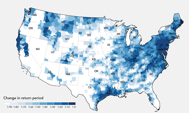
This map is of a climate-driven precipitation model predicting the increase in 1-in-100-year flood returns from extreme rainfall events for the United States based on US Government (NOAA) data from the period 1910–1995 compared to the most recent precipitation data of the 21st century.
David Mears was the executive director of Audubon Vermont from 2019 to 2023. Cassie Wolfanger is a Conservation Research Fellow with Audubon Vermont. This story first appeared on the Audubon Vermont website at vt.audubon.org.