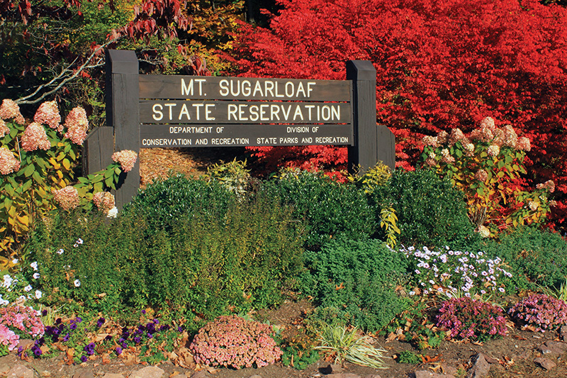


Mount Sugarloaf Sign.
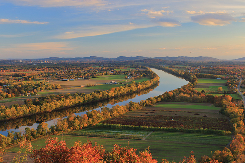
Last fall I set out once again to witness the magnificent foliage of Mount Sugarloaf in the late afternoon light. With its iconic views of the Connecticut River, which are frequently shown in books, calendars, and even in movies, Mount Sugarloaf is one of western Massachusetts’s premiere hiking and fall foliage viewing destinations. Few summits anywhere can boast a finer prospect for a relatively modest elevation.
Located in Deerfield, Massachusetts, Mount Sugarloaf comprises two sandstone peaks separated by a small gap. The 652-foot South Sugarloaf, the main attraction, sits atop a steep cliff at the massif’s narrow southern tip. From a three-level pavilion and other vantages, striking views encompass the Connecticut River and adjacent farm fields and woodlots, the Mount Tom and Holyoke ranges on the southern horizon, and the University of Massachusetts campus. Across the river to the east is a quintessential New England scene: the town of Sunderland nestled beneath the long ridge of Mount Toby and adjacent Pioneer Valley hills. Northerly and westerly perspectives extend to the Berkshire Hills and southern Green Mountains.
Adjacent North Sugarloaf, a larger mass of conglomerate bedrock, has a quieter, undeveloped character. Though its 790-foot summit is wooded, a nearby rock ledge offers westerly views across farm fields in South Deerfield to the Berkshire foothills. Natural communities include unfragmented oak-hardwood forests, an upland swamp, mountain laurel groves, and woodland brooks.
Mount Sugarloaf owes its scenic character to its location at the southern end of the Pocumtuck Ridge, which stretches for 11 miles along the Connecticut River’s west banks to Rocky Mountain and Canada Hill in Greenfield. The northernmost extension of the Metacomet Range, the Pocumtuck Ridge hosts a variety of natural communities that provide crucial habitat for migratory songbirds, raptors, and other wildlife. Roughly a mile upstream from its confluence with Connecticut River, the Deerfield River flows through a narrow gap in the range at the Greenfield town line.
Indigenous Pocumtuck peoples named the mountain Wequamps, meaning “where a hill falls off,” a reference to South Sugarloaf’s abrupt cliff. According to Native lore, the Pocumtuck Ridge is the preserved remains of a giant beaver that lived in a lake in the present Connecticut River Valley. Interestingly, the story may have a historical basis. After the last ice age ended more than 10,000 years ago, glacial Lake Hitchcock inundated much of the valley, and a now-extinct giant beaver species (Castorodies ohioensis) inhabited northeastern North America.
Colonial farmers from the nearby town of Hadley gave Mount Sugarloaf its present name for resemblance to a molded loaf of sugar. A rise of tourism during the nineteenth century prompted construction of a summit hotel, similar to those built atop nearby Mount Holyoke and other Pioneer Valley peaks, in 1864. The three-story structure accommodated twenty guests, who enjoyed panoramic views from an elevated porch.
The state of Massachusetts purchased the summit area in 1908 and subsequently established Mount Sugarloaf State Reservation. Civilian Conservation Corps workers built an auto road to the top of South Sugarloaf during the 1930s. After the summit house burned in 1966, the present pavilion was erected on the site.
Mount Sugarloaf Autumn View, 2021.
The most direct hiking route to South Sugarloaf’s vistas is via the southernmost portion of Pocumtuck Ridge Trail (PRT), a blue-blazed long-distance trail that traverses ancient Native American and Colonial paths along the crest of the range. From a trailhead at the base of the auto road, PRT follows a series of short switchbacks up the south cliff, gaining 460 feet in 0.4 miles. Though the climb is fairly short, some may find hiking poles helpful to mitigate knee strain.
For a longer but more gradual 1.0-mile ascent, follow Old Mountain Trail along the west slopes to the gap between North and South Sugarloaf, then turn right and make a 0.4-mile climb to the summit on PRT, which passes by a hairpin turn in the auto road and a fine easterly view of Sunderland and surrounding hills. Many hikers combine PRT and Old Mountain Trail as a 1.4-mile circuit. I recommend walking this loop counterclockwise, which allows for generally safer footing on the south cliff and an easy segment on Old Mountain Trail at the end.
On the north side of the gap, PRT continues for roughly 1.4 miles to the vista near North Sugarloaf’s summit. The segment, an optional out-and-back extension to the South Sugarloaf loop, is somewhat rugged, as the trail descends nearly 200 feet to the base of the east slopes before winding back up the ridge. The Hemlock, Witch Hazel’s Wander, and Aspiring Oaks trails provide options for less-traveled circuit hikes on North Sugarloaf. Limited parking is available at the Hillside Road trailhead on the north side of the mountain.
You can also drive, walk, or bike to South Sugarloaf’s summit on the auto road, which is open to vehicles from 9:00 a.m. to sunset from mid-May to mid-October and to pedestrians year-round. A parking fee ($5 for Massachusetts residents, $20 out-of-state) is charged at the summit, where visitor facilities include a picnic grove and seasonal restrooms.
Late October is the best time to enjoy peak fall foliage, which often lasts into early November due to the low valley elevation. Autumn also provides opportunities to observe migratory raptors, songbirds, and monarch butterflies traveling south along the Connecticut Valley flyway. Mount Sugarloaf is one of only five rock cliff sites in Massachusetts used by nesting peregrine falcons, which are recovering from twentieth century declines caused by DDT poisoning. I was fortunate to observe a peregrine staking out prey from South Sugarloaf’s cliffs several years ago.
John Burk is a writer, photographer, and historian from western Massachusetts whose credits include 15 books and guides and articles in nature and regional publications.
To reach Mount Sugarloaf State Reservation:
From Interstate 91 in Deerfield take exit 35 (from the south) or 36 (from the north) and follow MA 116 south to the intersection with Sugarloaf Street at the main entrance.
For more information, see mass.gov/locations/mount-sugarloaf-state-reservation.