We will now consider another source of fascination with wildlife to continue our investigation.
We will now consider another source of fascination with wildlife to continue our investigation.
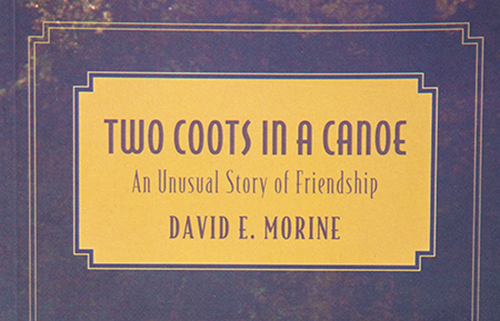
Book memorializes 400-mile paddle down New England’s great waterway
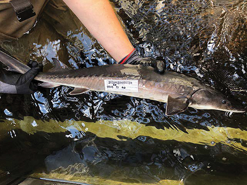
Few fish can rival the longevity or storied ancestry of shortnose sturgeon, a primitive animal that can live up to seven decades or more, and whose ancestors literally swam with the dinosaurs. “Recently, paleontologists found a fossil record, showing remnants of a mass dinosaur killing, and there were sturgeon and paddle fish carcasses, stacked together,” Micah Kieffer, a fisheries research biologist said.
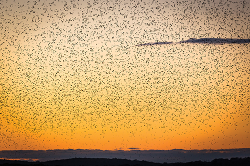
In countless numbers they assemble in the sky, in the quickening September dusk, to perform a swirling synchronized ballet. It is mesmerizing and indescribable; words cannot prepare the viewer.
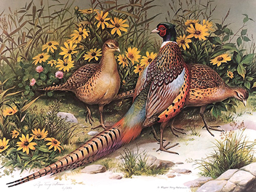
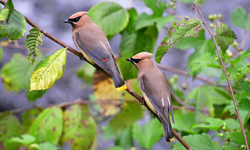
I still remember the first time I was handed a copy of Roger Tory Peterson’s A Field Guide to the Birds and my orientation as an incidental bird observer shifted to intentional bird identifier. I was 12 years old.
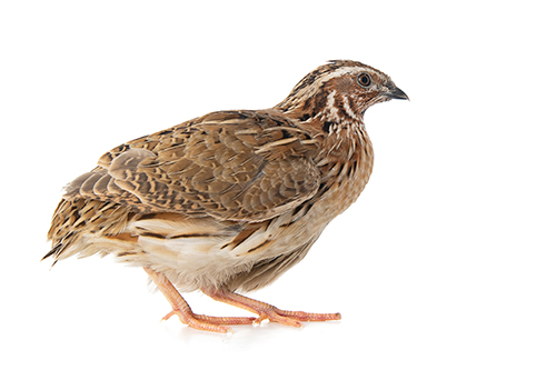
Quail is an upland gamebird, which, according to Wikipedia is an American term that refers to “non-waterfowl birds hunted with pointing breeds, flushing spaniels, and retrievers.” However, if you’re not “game” for dashing through field and wood and pulling shot out of your prey, thankfully there are many choices today from your local gourmet shop or butcher.
Three miles from the Connecticut River, we stood in a circle under a tree in the garden of Emily Dickinson’s home, reading poems, passing a book around, no more than two or three feet from each other. The 1813 Amherst home built for her grandparents stood proudly in the sunshine, and the voices of another tour group filtered out.

The best time to row is early in the morning when the water is quiet and the only people on the river are morning fishermen and crabbers.
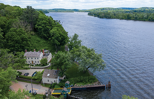
The car bumps over the railroad tracks and along a marsh to the end of the road. A few men in white outfits wave you over a small metal drawbridge and onto the historic 1949 Chester-Hadlyme Ferry. With a lurch, the 100-ton ferry leaves the west bank, chugging across the gently lapping waters of the Connecticut River.
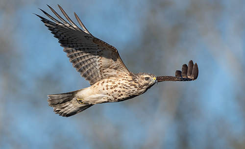
Their insistent “KEE-aah” has woken us up at daybreak as they screech across the hayfield trying to scare up breakfast. They’re noisy neighbors, our resident pair of red-shouldered hawks.
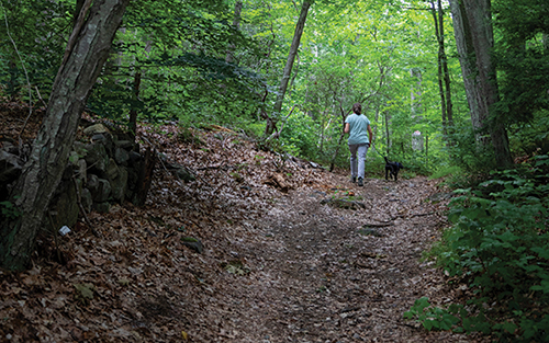
When I go there now, two or three times every week, I walk to the end of one road and trudge up a broken old
woods road into the state forest.
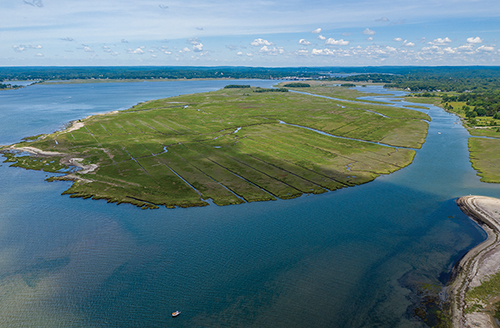
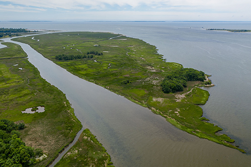
This magnificent estuarine expanse is both an aesthetic and utilitarian asset. Estuaries sequester about 20 percent of the world’s carbon, cleanse our waters, and provide comfort and sustenance to countless species, including our own. If you haven’t experienced this salty idyll, up close and personal, put it on your “to see” list.
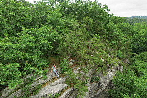
Everyone has a favorite place in nature. Ours is a rocky outcrop rising 300 feet above our village on the Connecticut River. Native Americans called these ledges above the stream valley Tomheganompakut, meaning “at the Tomahawk Rocks.” The hard, granitic schist was the source of their stone axes, or “Tomhegan.”
The first thing that hit me was the
smell—a damp, woodsy, uplifting
aroma that can only be described
as the scent of Christmas. After
several hours in the stale air of my
car, the pungent aroma of balsam
fir was invigorating
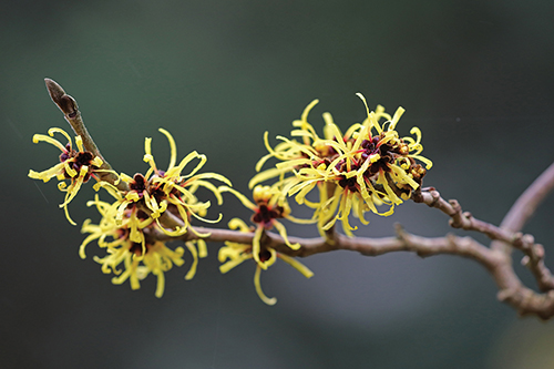
Walking through the Connecticut River Valley woodlands in the autumn, you might happen upon a large understory plant with gentle golden star-flowers and few leaves, a strange anomaly this late in the year. This is witch hazel, sometimes called spotted alder or winterbloom, and grows throughout New England, appearing to be a large, irregular shrub or small tree.
Land trusts as a mechanism for preserving land for public use have existed for thousands of years. However, most land trusts in the United States established for conservation purposes were created after World War II, starting in the 1960s and 1970s, and continuing today.
My wife and I had just spent the night in a tent high up in the Tien Shan Mountains of eastern Kyrgyzstan, just down the road from where the Russian cosmonaut Yuri Gagarin
prepared his physique for space flight.
One theory of our fascination with animals holds that we observe them, in their native habitats and in zoos, to discover deep origins of our current behavior. In short, we view animals as reflections of ourselves and we watch them to learn more about us.
You are invited to attend a virtual public comment meeting for Connecticut’s proposed National Estuarine Research Reserve (NERR).
The meeting will be held on Tuesday August 4th, 2020, from 7:00 to 9:00 PM EDT via WebEx.
Last time, we parted with my advice to first become informed about the state of the environment and then develop the conviction that you can make a difference to the environment by volunteering in an area that interests you.
If you are still left wondering what you can do, you can start your involvement by looking no further than your personal lifestyle, back yard, or neighborhood.