You walk into a dark grove of trees, chanting the rhymes of a poem. You note the bundles of five needles and long cones that mark these as white pines. And then it is on to the next clue, and the next.
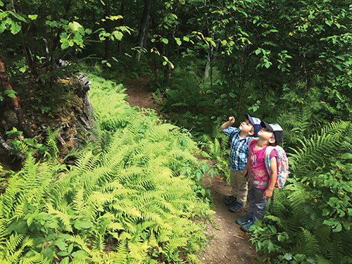
You walk into a dark grove of trees, chanting the rhymes of a poem. You note the bundles of five needles and long cones that mark these as white pines. And then it is on to the next clue, and the next.
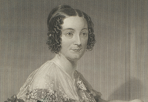
Three miles from the Connecticut River, we stood in a circle under a tree in the garden of Emily Dickinson’s home, reading poems, passing a book around, no more than two or three feet from each other. The 1813 Amherst home built for her grandparents stood proudly in the sunshine, and the voices of another tour group filtered out.
By now, knowledge that invasive plants are bad news is pretty widespread. Numerous articles and agencies cite “billions of dollars” in damages annually to agriculture and fisheries; they are the “leading cause” of population decline and extinction in animals.
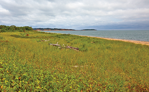
In summertime, looking across the Sound, my thoughts turn to Plum Island, New York. I believe this island could be designated a public park and nature sanctuary into perpetuity if accompanied by various restoration imperatives.
It seemed like just another spring day when we stopped at the Salmon River, a tidewater tributary of the Connecticut River that splits the towns of Haddam and East Haddam, Connecticut.
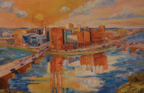
Hands on the Land: Art & the Environment in the Connecticut River Valley” is a collaborative exhibit between the Connecticut River Museum and the Lyme Art Association.
Welcome to the lower Connecticut River valley! This last section of the river, just before and as it reaches the Atlantic Ocean, is a scenic and grandiflora tour de force that rivals any along the eastern seaboard of the United States. Birders, naturalists, and the first American Impressionist painters—anyone in love with nature and her bounty—have for centuries known about and continue to find wonder in and draw inspiration from this greenest of green deviants from the generally-overpopulated coastline.
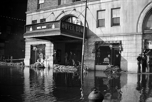
On March 11, 1936, rain began to fall on the hills of Vermont and New Hampshire. The next day it didn’t stop, nor the next, depositing at least five inches of water over New England. The snowfall had been heavy that winter, and as snowbanks washed off the hills, people stared nervously at the rapidly rising levels of their local streams and rivers.
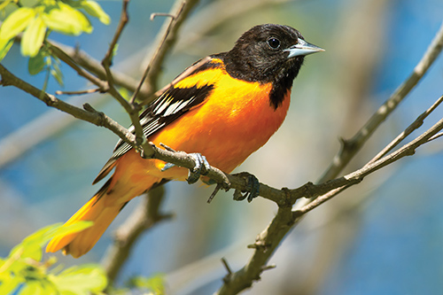
Few birds can match the eye-popping beauty of the male Baltimore oriole or the flying prowess of the ruby-throated hummingbird.
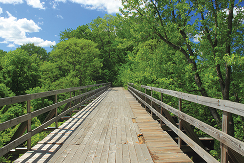
Diverse rail trails help preserve the central Connecticut River watershed’s rich railroad heritage. After many of the region’s railways, including the extensive Boston and Maine Railroad network, discontinued during the twentieth century, conservation and community organizations created trails on the abandoned corridors.
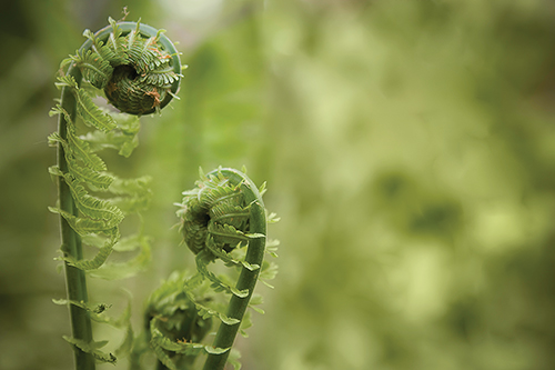
They’re delicious and free for the picking! Before the oaks and maples leaf out in early spring, tasty fiddleheads are pushing through the bronze leaf litter in moist woodlands throughout New England.
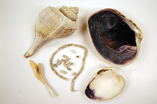
We all like to visit the beach in warm weather. We like to stick our toes in the sand, wade in the water, maybe collect a few shells. The Native Peoples of the Connecticut shore and estuaries did just that hundreds of years ago. For them, certain shellfish not only fed the body but sustained the spirit as well. Quahog clams and large whelks were of particular importance for the creation of a small bead called wampum.
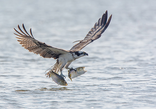
For a week, I “mirrored” the contents of 24 nest poles in the Great Island osprey colony. I use a light convex bicycle mirror on the end of a long, curved bamboo wand. Standing on the salt marsh below a 12-foot-high nest platform, with my arms raised, I could check the progress of each nest.
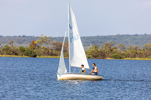
Among my favorite memories is when my sailing camp got the whole day to race against each other in different sailboats.
Volume II, Issue I. These few words, in fact, speak volumes. Estuary’s Volume I, Issue I, better known as Spring 2020, came out, arguably, at the worst possible time for a new print magazine. The publishing industry had long since administered last rites to print magazines in general, so why did we think we could succeed with Estuary?
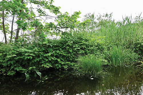
It would be hard to proclaim which plant wins as the worst terrestrial invasive species in the US, but Japanese Knotweed, Polygonum cuspidatum, is a clear contender.
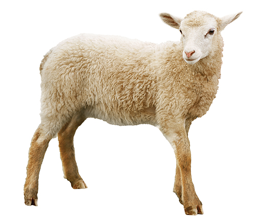
Lamb vs. Mutton
They are both domestic sheep…but hardly interchangeable.
I put my hand out in front of me like I’m offering to shake and say: “How do you do, sir. I’m called JJ, just like my father, and his father, and his father before him. We’re all ferrymen here in Old Saybrook, and we’re all called JJ.”
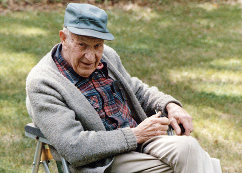
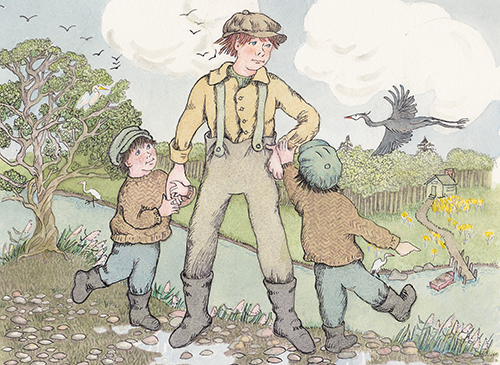
Oliver LaPlace was born on the Connecticut River, almost. The family homestead in Lyme backed up to its eastern shore. They had to keep a close watch on young Ollie, especially during the spring freshet. He was drawn to the water something fierce.
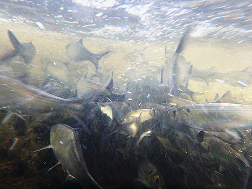
Historically, each spring throngs of migratory fish from the ocean surged up the Connecticut River and its tributaries as far inland as they were able.